Geological
Processes
This section describes the effects of geological processes that are dominated by seafloor spreading - a process that is currently occurring at around rates between about 10 mm and 4 cm/yr in our region. That is a lot of movement. Mountain ridges around the headwaters of the Bogacheal River are RISING that much.
The following images summarize the current knowledge sets. It should be recognized that much of this information is VERY new, and that human understanding of the geology of the world is very new - the late 20th century - and human understanding of what's going on under the Pacific Northwest is some of the newest information in the world.
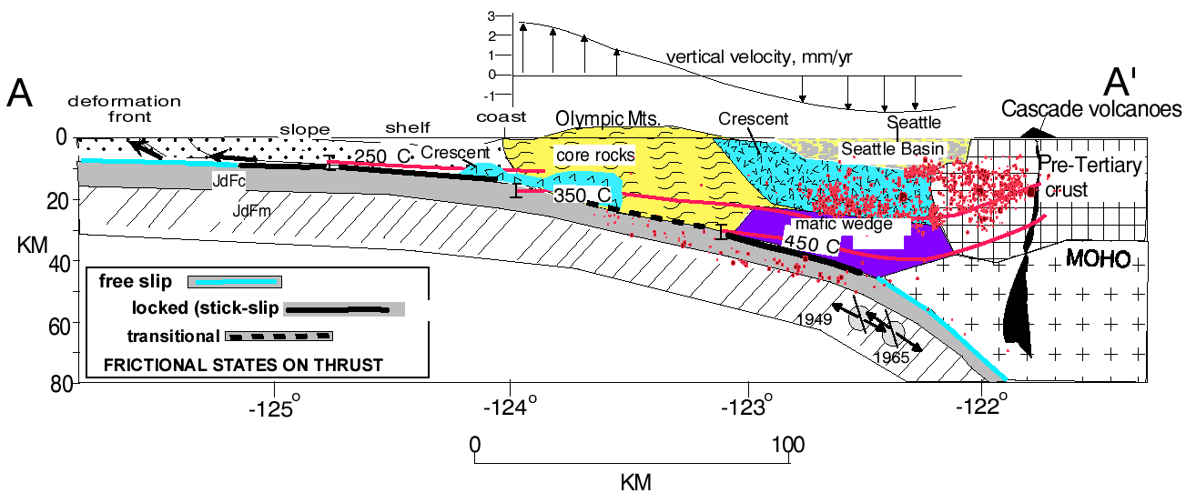
The geology of the Olympic Mountains was initially decoded in 1978 - barely 30 years ago. The following images are from the 1999 USGS Report SUBDUCTION ZONE AND CRUSTAL DYNAMICS OF WESTERN WASHINGTON: A TECTONIC MODEL FOR EARTHQUAKE HAZARDS EVALUATION which is one of the most interesting papers I have ever encountered.


What these maps have not told you explicitly is that this is one of
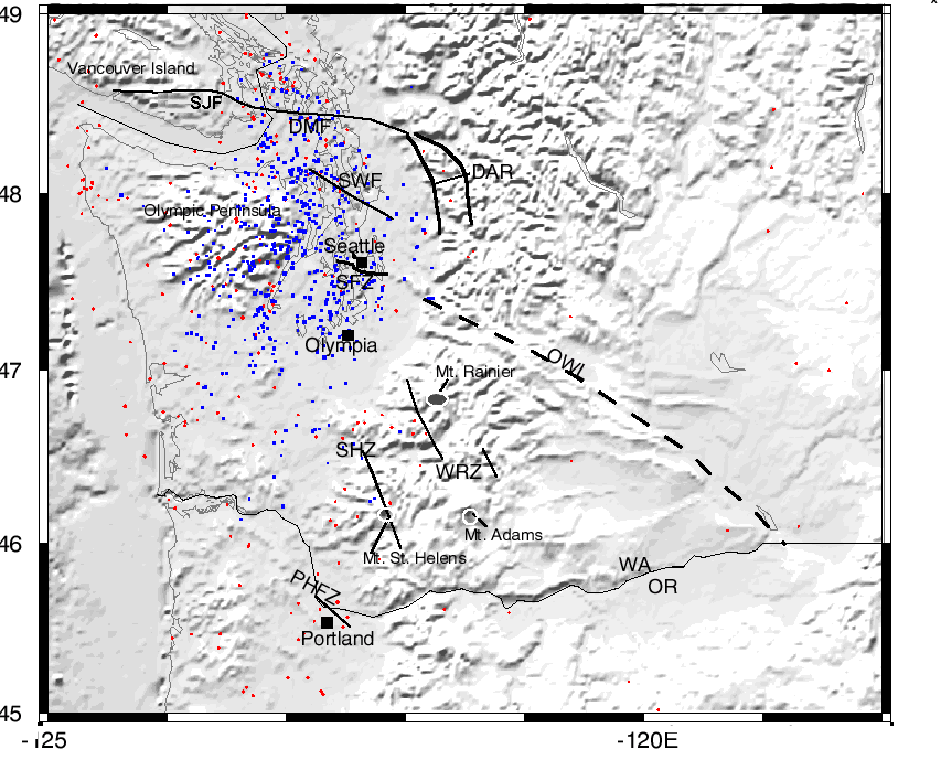
the youngest and most tectonically active landmasses on Planet Earth but they do show that we are right in the middle of something major. The next map ought to calibrate you. The map above locates only the earthquakes that occurred during the past 27 years!

This map shows all of the earthquakes (from the Pacific Northwest Seismic Network), including those relocated using the tomographic velocity model. The colors represent depth ranges for the earthquakes with red for 0-10 km, green for 10-20 km, blue for
20-30 km, and black for 30-60 km. PHFZ=Portland Hills fault zone, SHZ=St. Helens zone, WRZ=western Rainier zone, SFZ=Seattle fault zone, SWF=South Whidbey Island fault, SJF=San Juan fault, DMF=Devils Mt. fault zone, DAR=Darrington fault zone,
OWL=Olympic-Wallowa lineament.
I believe you need one more map to get the picture solidly established: the location of the deep earthquakes. Go get it!
http://pubs.usgs.gov/of/1999/ofr-99-0311/illusframe.html
No comments:
Post a Comment